Showing posts with label GeoTagging. Show all posts

Saturday, February 18, 2012

Flickr Photo Viewer, for Current Events in the Classroom?

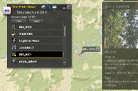
Here's an interesting web application that lets you do a keyword search in Flickr and then maps the images with a marker and thumbnail.


What you can do:

    * Find a location in the world in a flash.
    * Search flickr photos with your desired keywords.
    * Explore flickr photos that are taken after a specified date.
    * Click on the small thumbnail to enjoy the whole picture.


Perhaps the best use of this tool is to combine the date and keyword search, to track photos streaming into Flickr during or after an event.  Should be great for exploring current events in the classroom!


For science class, search for crocus or other phenological indicators and set a start date of February 7 for example.


Tuesday, July 19, 2011

Mapping Geotagged Images from Flickr in Less than 10 Seconds

This video is a quick tutorial for streaming geotagged images into the map viewer at ArcGIS.com.  The map viewer was recently updated and now has a great utility for KML files, among many other great new features.

Tuesday, February 22, 2011

GeoTech 2011 - GeoTagging and More in Dallas, TX

Bishop Dunne GeoTech Conference, March 3-5, 2011


GeoTech is the superb gathering of educators in Dallas, TX during the first week of March.  This year, the conference will include a GeoTagging workshop Thursday afternoon, presented  by Tom Baker &  Roger Palmer.  


Required software


Required data


Be sure to see the Mobile and Web GIS tools for the classroom  presentation on Friday!

Friday, February 11, 2011

Finding Needles in Haystacks: Learning from patterns in GPS data

Finding Needles in Haystacks: Learning from patterns in GPS data
by Roger Palmer, GISetc & Tom Baker, Esri
at TCEA 2011 in Austin, TX

GPS gets your students out into local environments and interacting with the world. See how simple it is to integrate geocaching, EarthCaching, and data collection into your classroom.

Download the Session Presentation [PDF]. 

Wednesday, November 10, 2010

CAST 2010: A Picture's Worth a 1000 Lessons

We'll be in Houston, TX for the Texas Science Teachers' Convention CAST!  The presentation is Friday.


Code:  WS2184

Today's cameras are truly tying more data together in rich and meaningful ways. When combined with GPS locations these tools can really be powerful data collection devices to do investigations. We will cover how to get your pictures position information, how to store this information, what to do with geotagged images once taken and finally how to best use them as class room tools in many different sciences. It won't even have to come out of your science budget!

Audience:  Teacher / Pre-Service
Grade Level:  Middle School
Content:  Earth / Space Science / Life Science
Start Time:                    4:30 PM - 5:30 PM
Scheduled Room:         362 AD

Updated 11/15/2010: Session PowerPoint now available for viewing or download via Google Docs.

Wednesday, September 29, 2010

Resources for #NCGE GeoTagging Workshop (Thurs, 8am)

Resources for NCGE workshop:

 Download data pack [download 200K zip file] 

Agenda:

Thursday, September 16, 2010

"GeoTagging Media" computer lab at NCGE Conference (#ncge)

Dr. Shannon White and Dr. Tom Baker will be conducting a "GeoTagging Media" computer lab session at the upcoming meeting of the NCGE in Savannah, GA, Thursday September 30. 8:00-8:45 AM.

Conference attendees will be charged $10 for attending this session.  All proceeds to go to NCGE.  Learn more about the Esri sponsored GIS lab at the Esri Education Community blog

Tuesday, September 14, 2010

GeoTagging Media Webinar Recording Now Available (#ncge)

NCGE Webinar Series – GeoTagging Media
Duration:             00:49:49
URL for Viewing:              http://esri.acrobat.com/p76481044/
Summary:           NCGE Webinar Series - GeoTagging
Language:           English
Uploaded on:    09/14/2010 10:50 AM
Presenter:          Dr. Tom Baker, Esri Education Manager & NCGE Executive Planning Board

For information about other NCGE webinars to join NCGE, visit http://www.ncge.org

Resources for NCGE Live Webinar (#ncge)

Resources for today's NCGE live webinar:
Optionally, download data pack [200K zip file]

    Wednesday, September 8, 2010

    NCGE Live Webinar: GeoTagging Media

    Please join NCGE for our next live webinar on Tuesday September 14, 2010.

    Webinar: GeoTagging Media

    Date: September 14, 2010, 11AM Central

    Description: This webinar is an introduction to geotagging digital photos and other media using ArcGIS Explorer Online, ArcGIS Explorer Desktop, and other free tools. GeoTagging is the process of assigning geographic information to digital media for mapping and visualization purposes.  GeoTagging is great for class field trips, outdoor field experiences, storytelling, and travel.

    Presenter: Dr Tom Baker, Esri Education Manager

    Visit http://ncge.org for more information.

    Saturday, July 10, 2010

    GeoTagging at ESRI Education User Conference

    This Saturday, July 10th kicks off the 10th annual ESRI Education User Conference with user presentations, computer labs, and plenty of special events.  One of the computer labs is "GeoTagging Media and Incorporating Multimedia into ArcMap" to be held 1:30-2:45 Saturday.

    The session will focus on ArcGIS Explorer and supporting web and desktop technologies.  Software for geotagging will include
    We'll also have a lineup of hardware geotagging devices for use in education, including GPS units, data loggers, GPS-enabled cameras, and more.


    If you are attending the conference, the lab is "first-come, first-serve".  Grab you seat early!  It will fill.

    Wednesday, June 30, 2010

    GeoTagging Resources for #ISTE10

    Below you will find the sample data pack for the noon BYOL GeoTagging workshop at ISTE '10.

    Updated: Download data pack [200K zip file]

    Download Google Picasa [Windows | Mac | Linux]

    Other resources  referenced:
    The GeoTagging presentation (PDF) is also available for viewing or downloading.

      Monday, June 28, 2010

      GeoTagging Twitter Text with iPhone & GPSTwit (#ISTE10)

      Last Fall, Twitter began adding support for geolocating Twitter posts (Tweets). This is an opt-in feature of Twitter, that you must enable.  To enable this feature, log in to Twitter and select "Settings" in upper right corner.  Under the "Account" tab, check the box for " ". This will allow Twitter.com (image 1 - note the toolbar at top requesting to use my location) or third party apps to distribute your location with each Tweet.   More details, privacy info, and an F.A.Q about "geotagging" Twitter posts is available from Twitter.


      One easy-to-use iPhone app for posting geotagged Tweets to Twitter (including photos) is GPSTwit (not to be confused with GPSTweet whch Tweets your position only). At $.99, this little app allows you take a photo, include a Tweet, optionally geotag, and post a Tweet to Twitter.  The image is displayed on GPSTwit.com, along with other images. Recently I posted a picture of downtown Denver during the ISTE 2010 conference (#ISTE10).

      It's fast, simple and works great for geotagging text or text+pic.

      Sunday, June 27, 2010

      GeoTagging Made Simple with iPhoto '09

      If you're like most Mac users, you probably already have a large number of photos in iPhoto. Hopefully, you're using iPhoto '09 (retail price: $0 with new Macs; $79 US upgrade) because no prior version has the built-in support for geolocating your pics.

      From Apple.com:
      "Places allows you to search and sort photos by location, using data from any GPS-enabled camera or iPhone. Don’t have a GPS-enabled camera or iPhone? You can still use Places by adding your own location information: Just start typing and iPhoto instantly gives you a list of locations to choose from. Want to add places to lots of photos? Select an Event, an album, or a group of photos shot in the same place, and iPhoto can add your location information to all of them at once."

      To geotag an individual photo:
      1. Click the small “i” icon in the bottom right corner of your photo (image 1). This will flip your picture over.
      2. Click on the words “photo place” and then on “find on map”.
      3. You can now put in the location of your picture either by adding the street address, city and state/country, latitude and longitude, or certain well-known locations by name (e.g. St. Louis Zoo).
      4. Click “Assign to Photo” when you have found the correct location.
      5. You can also add a description of the photo by clicking on the “description” word and typing into the box. You can rename your photo here as well by clicking on the name .
      6. Congratulations! You have just “geotagged” your photo! All your information should now show up. You can zoom in and out on the map, as well as switch between “Terrain”, “Satellite”, and “Hybrid” views.
      - Alexis

      Wednesday, June 16, 2010

      Geotagged Images in ArcGIS Explorer with GeoRSS

      ESRI's ArcGIS Explorer is a free digital globe for Windows - a two and three dimensional mapping tool with several base maps and supported data types.  It will load and display all kinds of GIS data (shapefiles, geodatabases, rasters, connects to ArcGIS, etc) and also data like KML and GeoRSS.

      If you have already created a gallery of geotagged images in one of the many photo sharing websites (e.g. Flickr, Picasa Web), you can easily ingest a feed (or data stream) of you photos with the geography intact. This feed is in the form of a GeoRSS file and is created each time it is called by ArcGIS Explorer - meaning your images are always up to date.  The power in this approach is that you can select images from different galleries and different websites, displayed against a variety of base maps and other geography.  You can see my ArcGIS Explorer GeoRSS Photo map at ArcGIS.com.

      To create your ArcGIS Explorer GeoRSS photo map
      1. For Flickr users, scroll to the bottom of your Photostream page and find the "geoFeed" link.  You'll want to copy this URL and use it in ArcGIS Explorer. Be sure you have relevant location sharing options turned on.
      2. For Picasa Web Albums users, select a gallery, select an Album and find the "RSS" link.  You'll need to copy this URL and use it later in ArcGIS Explorer. Note that you must have created an "Album Map" in order for the RSS feed to contain geographic data.
      3. Open ArcGIS Explorer and press "Add Content".  Select "GIS Services".
      4. Press "New Server Connection".
      5. Change Server Type to "GeoRSS" and paste your geoFeed or RSS URL from Flickr or Picasa Web Albums. 
      6. If you receive an error, the first and most likely problem is that all proper location sharing options in Flickr or Picasa Web Albums are not enabled.  Revisit and try again.
      You can repeat the above process until you've added all the geotagged photos you want. Change your base maps and add more geo data to make it yours.

      Lastly, if you want to share your ArcGIS Explorer file, save your work as an .nmf (file) and upload to ArcGIS.com.  The accounts are free and take only a second to set up.

      Thursday, May 27, 2010

      Upcoming workshop: GeoTagging Media and Incorporating Multimedia into ArcMap

      Learn to use and create geotagged media to facilitate classroom inquiry! This hands-on workshop will explore several web and desktop tools for geotagging images and media. ArcGIS Explorer and other tools will be used to create maps and visualizations of the media. Optionally, bring some of your own JPG photos on a USB drive.

      Attend the ESRI Education User Conference, July 10 - 13, 2010 in San Diego, CA.  More info: workshop | conference.

      Friday, March 19, 2010

      Geotagging at the National Conference on Science Ed - NSTA 2010 Philly


      Taking a bit of advice from this very blog, I decided to geotag my trip to the 2010 National Conference on Science Education in Philadelphia, PA. To help me keep up with it all, Anita Palmer also contributed several images

      I'm using an iPhone and PixelPipe and occasionally, a Nikon P6000 (with built-in GPS) to record my images and post to Google's Picasa Web Albums. The iPhone can use either its GPS or cellular triangulation.  As many of these photos are being taken indoors, it seems that most of the positioning info is coming from the cellular triangulation.  I seem to keep "clumps" of pictures that are pretty close, but not spot-on.  As a result, I'm tweaking the position of many of these pictures, using Picasa Web Albums.

      Since I'm geotagging and posting these images in (mostly) real time, each time you visit the gallery you should see new pics.  Granted, the conference itself may not provide a wealth of geography across which my pictures can post, but hopefully I'll see a few sites while in Philly and add those to the map as well.

      • 2010 National Conference on Science Education geotagging project [ images | map-based ]
      If you would like to contribute to this gallery, email your geotagged photos to:  trbaker.nsta2010@picasaweb.com by Sunday, March 21 (6pm EDT). Include your name and description.


        Wednesday, March 17, 2010

        GeoTagging with your own iPhone:Using PixelPipe

        Editorial Note: Pixel Pipe no longer transmits the location of the image at the time it was taken but rather the location at the time the image was transmitted.  Pixel Pipe can still be a useful tool for students, if that can transmit the images immediately after taking them. (06/23/2010)

        If you are a lone geotagger with an iPhone, you have many options (iPhone apps) for publishing your pics to the web.

        I've experimented with a few photo-sharing applications, but I seem to keep coming back to PixelPipe, a service and an application for publishing pictures to a number of photo-sharing websites. PixelPipe's website boasts, "Publish photos, video, audio, text and files on over 100 online destinations and counting...".  It is impressive!  PixelPipe can run on Apple iPhones, Google Androids, Palm Pres, and several others. They've also created photo-sharing apps (or plug-ins) for: Firefox, Picasa, Google Talk and more.

        Basically, you stick a PixelPipe application on any of the devices or tools above, configure through the web interface one time, and then press "Upload".  Depending on how you've configured PixelPipe, your photos can publish to one or a hundred different websites - at the touch of a single button.  It's very powerful - and free.

        This is a great way for the solo geotagger to make quick work of publishing images to a photo-sharing website that supports geotagged images, like Flickr or Picasa Web Albums. You can even tie PixelPipe to your Twitter account to automatically tweet about your newly uploaded pics.

        The screenshots above are from PixelPipe running on an iPhone 3GS (publishing to Picasa Web Albums). Enjoy!
        Tuesday, March 16, 2010

        GeoTagging with student iPhones and Picasa Web Album

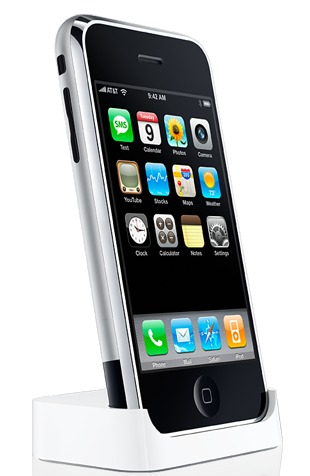
        GeoTagging with an Apple iPhone 3GS is an absolute snap!  With a camera and GPS built-in, you just point-and-shoot.  The challenge can be transfering these geotagged images to an online service that maps your pics. However, using the "email feature" in Picasa Web Album resolves this issue quite handily.

        Why an iPhone?
        Apple iPhones have gained rapid and dramatic market share in consumer mobile devices.  This trend may be the most evident among kids and young adults.  My own informal polling of students, teachers, and principals leads me to suspect that anywhere from 25% to 50% of middle schools students are carrying one of these devices.  While many of these students have pages of apps and the Apple data plan, few of them can buy an app.  For teachers, this means that potentially 50% of students in your class are carrying their own data collecting device that will geotag images.  Students can email the geotagged images directly from the iPhone to Picasa Web Albums, after making a few tweaks in Picasa.

        Setting up your classroom Picasa Web Album
        1. If you don't already have a Google account your use for the classroom, create one.
        2. Login to your classroom account and head to Picasa Web Albums
        3. Click on "Settings" in the upper-right corner.
        4. On the "General" tab, check the box next to "Upload photos by email" and note the special email address you're given. after entering a secret word (usually an @picasaweb.com address).
        5. Now, when your students take a geotagged photo, they just email it to this address. 
        6. These emailed photos will appear in a "Drop Box" folder and will need to be moved to another public folding of your choice.

        Steps for classroom activities
        1. Students use the built-in iPhone camera app to take a geotagged photo.
        2. Students share the photo by emailing it to the address, provided by Picasa.
        3. You (teachers) will need to move the photos to a new album.
        4. Students can then comment on their photos, contributing any other attribute information collected during the study.

        What a great way to empower students, engaging them with their tools and tech, while extending classroom and collaborative data collection!  Share your thoughts or experience below. 

        Wednesday, March 10, 2010

        GeoTagging in your everyday life: Spring Break

        One great way to start geotagging is to geotag pictures from a vacation or special event.  The zoo, amusement park, county fair, or park are excellent places to "practice" geotagging.  Photographically, you can shoot interesting subjects that vary across geography.

        As Spring Break nears, consider geotagging your photos from a trip or vacation, at least the ones you're willing to share.  It's another opportunity to create some exciting maps from your own adventures!  I had the extremely good fortune of traveling to Africa in 2008.  As the trip grew near, one of the first things I did was purchase a new camera, the Nikon P6000 - an excellent point-and-shoot camera (more on the P6000 in the future).  The interesting feature of the P6000 is that it has an onboard GPS, geotagging the photos with highly accurate positioning information as the pictures are taken (very cool).  Keep in mind a simple digital camera and a GPS is all you really need.  Just jot down the lat/long along with each picture number in a logbook, as you shoot.

        Feel free to explore my one day adventure into Lilongwe National Park, Zambia, Dec 25, 2008.  Share your geotagged trip URLs below and enjoy that Spring Break!