Select software used in demos:
- Microsoft ProPhoto Tools 2 (free)
- Esri ArcGIS Explorer desktop (free)
Data used in demos:
- ISTE2010_GeoTag.zip [186 Kb]


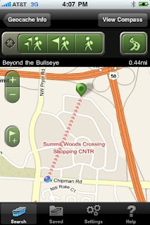
 Geocaching is a high-tech scavenger hunt that uses coordinates to navigate to a hidden treasure, or geocache. Before iPhones, a geocacher needed to purchase a GPS receiver in order to geocache. Now, you can download one of many apps to your iPhone and go on your first hunt. There area couple geocaching apps out there, but I like the Geocaching App from Groundspeak. The app does cost a few dollars, but it's a lot less than buying an expensive GPS. Once you have downloaded the app and registered on geocaching.com for your free membership, you are ready to go!