Showing posts with label ArcGIS. Show all posts

Saturday, February 18, 2012

Flickr Photo Viewer, for Current Events in the Classroom?

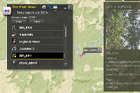
Here's an interesting web application that lets you do a keyword search in Flickr and then maps the images with a marker and thumbnail.


What you can do:

    * Find a location in the world in a flash.
    * Search flickr photos with your desired keywords.
    * Explore flickr photos that are taken after a specified date.
    * Click on the small thumbnail to enjoy the whole picture.


Perhaps the best use of this tool is to combine the date and keyword search, to track photos streaming into Flickr during or after an event.  Should be great for exploring current events in the classroom!


For science class, search for crocus or other phenological indicators and set a start date of February 7 for example.


Saturday, July 10, 2010

GeoTagging at ESRI Education User Conference

This Saturday, July 10th kicks off the 10th annual ESRI Education User Conference with user presentations, computer labs, and plenty of special events.  One of the computer labs is "GeoTagging Media and Incorporating Multimedia into ArcMap" to be held 1:30-2:45 Saturday.

The session will focus on ArcGIS Explorer and supporting web and desktop technologies.  Software for geotagging will include
We'll also have a lineup of hardware geotagging devices for use in education, including GPS units, data loggers, GPS-enabled cameras, and more.


If you are attending the conference, the lab is "first-come, first-serve".  Grab you seat early!  It will fill.

Monday, June 21, 2010

GIS for Geocaching

If you geocache with students or youth group members, take a look at a new one-page flier "7 Ways To Use GIS for Geocaching".  A GIS, or Geographic Information System, is a powerful digital mapping tool that for the geocacher can allow for the exploration or discovery of new caches.  For those managing a geocaching course or even just a large number of caches, a GIS can also help.

For students and youth, a GIS like ArcGIS Explorer desktop can be used to create a multimedia maps that serves as a "report out" the geocaching adventure.

If you have suggestions for enhancing the flier, please let us know.

As an aside, If you need a set of GPS receivers to use for a school or club project, consider the GSA's GPS loaner program operated by GISetc.   The loaners are free but shipping and insurance must be covered.


    Thursday, May 27, 2010

    Upcoming workshop: GeoTagging Media and Incorporating Multimedia into ArcMap

    Learn to use and create geotagged media to facilitate classroom inquiry! This hands-on workshop will explore several web and desktop tools for geotagging images and media. ArcGIS Explorer and other tools will be used to create maps and visualizations of the media. Optionally, bring some of your own JPG photos on a USB drive.

    Attend the ESRI Education User Conference, July 10 - 13, 2010 in San Diego, CA.  More info: workshop | conference.